Research + Design Advanced Studio


APPLE HOMES
The 'humans above, animals below' layout represents a form of vernacular wisdom born from cold-climate rural life—an architecture that balances energy efficiency with everyday convenience. This pattern appeared widely across the Alpine regions of Europe—Germany, Austria, and Switzerland—and found close parallels in northern China, the Mongolian Plateau, and the grasslands of Eastern Europe. Its defining feature is simple yet profound: livestock were sheltered on the lower level, while people lived above, the two layers linked by stairs, vents, or chimneys that created a tight loop of heat and life.
During the long winters, animals were brought indoors; their body heat and the fermentation of manure generated warmth that rose naturally into the upper living quarters, reducing the need for additional fuel. This spatial arrangement not only conserved energy but also allowed families to care for animals without stepping into severe cold. In summer, when herds moved to high pastures or outdoor sheds, the lower level was cleaned and repurposed for storing grain, drying hay, or serving as a shaded workspace. The house thus enacted a seasonal transformation—a cycle of containment and release, of shared warmth in winter and open ventilation in summer.


Coexist with Apples
Permenant
Public
Seasonal
SUMMER
FALL
WINTER


1 UNIT
= 1 permenant + 2 seasonal + 1 kitchen + 2-3 restrooms

FIRST FLOOR

SECOND FLOOR

THIRD FLOOR

SKY THROUGH THE ORCHARD

SKY THROUGH THE SKYLIGHT


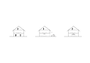
ELEVATIONS


WALL AND SKYLIGHT
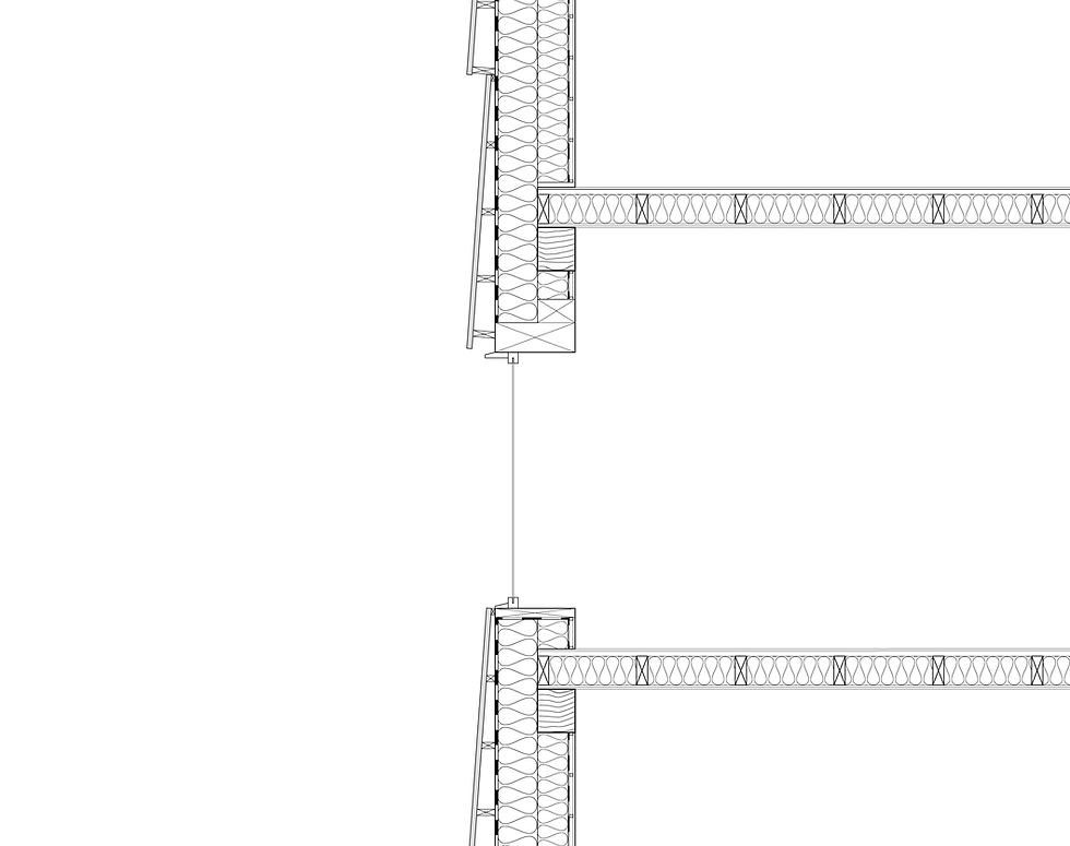
FLOOR AND WINDOW

CHESTER
FARM
CENTER
Site Analysis about axis, terrain and crowds
The fields of Chester Farm Center lie across gently rolling hills, scattered amid a vast and beautiful landscape. The soil is dry and loose, black as charcoal, and rich in nutrients essential for crop growth. When rubbed between the fingers, the fluffy earth feels like fine sand, slipping easily off at a light touch. Rows of greenhouses sit neatly beside the fields, as workers drive by on their utility vehicles.
The plot designated for the farmhouse is located on a higher slope beyond the farmland, where the terrain changes dramatically. Clusters of trees are scattered across the site, while a ring of orderly trees encircles its perimeter. From the highest point of the hill, through gaps in the trees, one can see the distant farmland. At the lower end, a dried wetland overgrown with weeds stretches toward a shallow riverbed that connects to a small pond on the western side. The pond water is murky, its surface covered with aquatic plants and algae.
This wetland divides the site into two parts: the northern section is smaller but relatively flat, while the southern section borders the waterway, featuring a terrace that rises sharply toward the hilltop. Standing on the slope, with a gentle breeze passing by, the trees at the center of the site naturally divide the space. Growing right along the steep incline, they split the southern area into eastern and western portions. The eastern side, near the road, enjoys an open view, while the western side is quiet and serene — the sparse tree clusters do not block the sunlight, making the area both peaceful and bright.

DEVELOPMENT PLAN

OVERALL PLAN

